Norway
  Deutsch
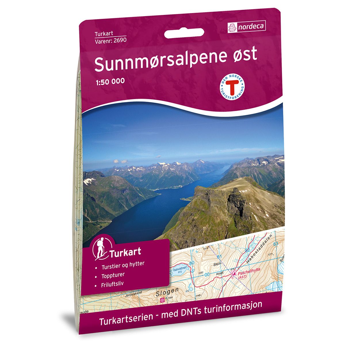
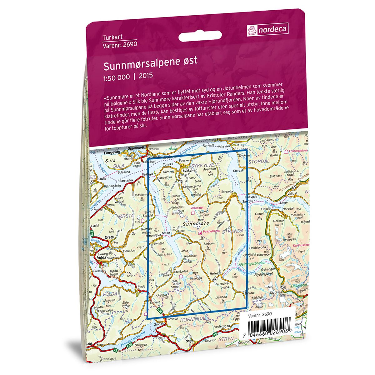
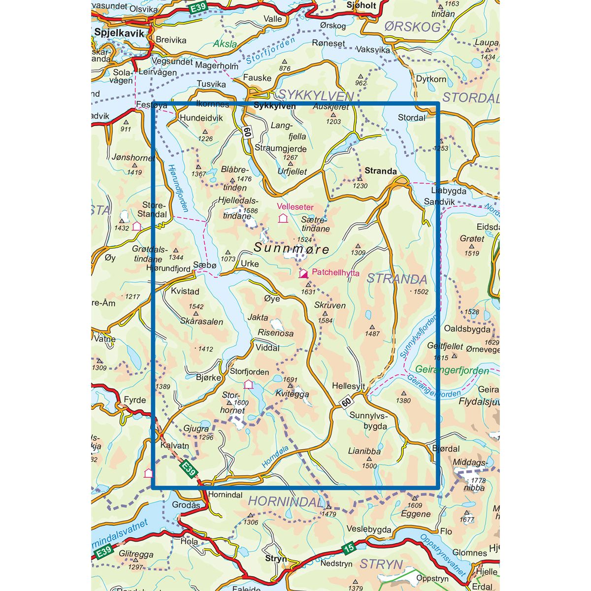

Sunnmørsalpene Øst DNT hiking map
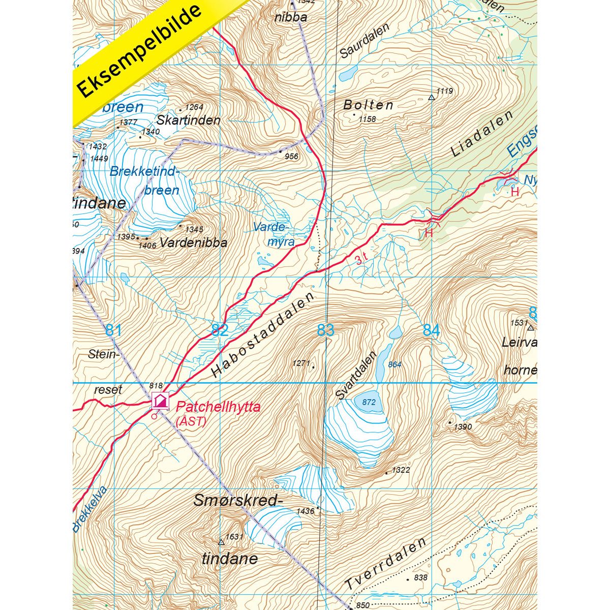
Map with Norwegian Trekking Association information about trails and cabins.
- The map covers Hjørundfjorden, Stordal, Sunnylvsfjorden og Voldsfjorden
- Scale 1:50 000 in water resistant material
€24.00
In stock
| Brand | Nordic Maps |
|---|---|
| SKU | 2690 |
| Map size | 70x100 cm |
| Scale | 1: 50 000 |
| Trails | Hiking trails |
| Updated | 2015 |
| Material | Plastic fiber |
| Map usage | Hiking |
| Accommodation | Serviced cabins, Unattended cabins, Self-catering cottages, hotels |
| EAN | 7046660026908 |
| Partner | The Norwegian Trekking Association |
| Map both sides | No |
| Country | Norway |
| Destinations | Hellesylt, Hjørundfjorden, Stordal, Stranda, Sunnmøre, Sunnylvsfjorden, Sykkylven, Voldsfjorden, Øye |
| Format | Foldable |
| Language | Norwegian, English |
| Series | Hiking maps |
Sunnmøre is a Nordland that moved to the south and a Jotunheim that floats on the waves. This is how Sunnmøre was described by Kristofer Randers. He was referring to Sunnmørsalpane, the Sunnmøre Alps, on both sides of the beautiful Hjørundfjorden. Some of the peaks can only be reached by mountaineers, but most can be climbed by hikers without any special equipment. Several hiking trails wind between the peaks. The Sunnmøre Alps has established itself as one of the best areas for ski tours to mountain peaks.
DNT hiking maps
This map series was developed in cooperation with The Norwegian Trekking Association (DNT) and contains DNT trails, cabins and other useful trekking information. A few of the maps also have ski trails.
The DNT maps are published in three different scales (levels of detail).
1:25 000 for more defined and detailed information. Suitable for shorter treks.
1:50 000 is the optimal scale for treks.
1:100 000 offers a good overview of larger areas and is useful when planning trips.
The maps are printed on durable and weatherproof plastic fibre or paper material.
Language: Norwegian and English