Norway
  Deutsch
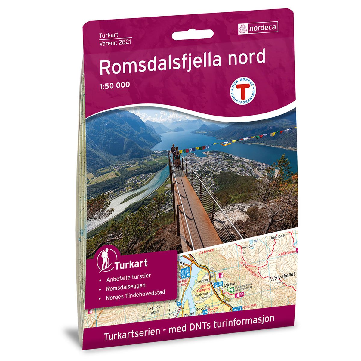
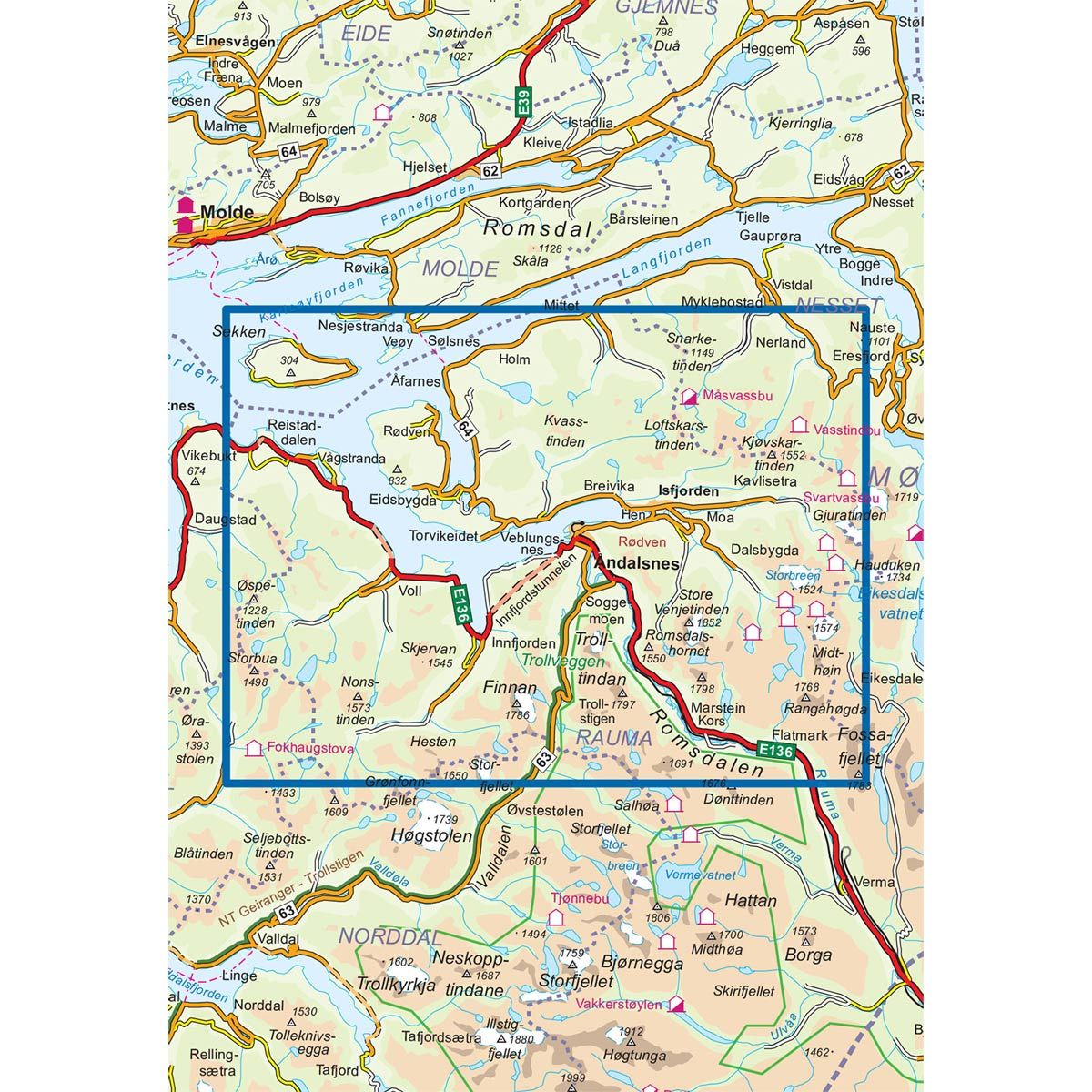


Romsdalsfjella Nord DNT hiking map
Map with Norwegian Trekking Association information about trails and cabins.
- The map covers Isfjorden, Voll, Rauma, Trolltindan og Åndalsnes
- Scale 1:50 000 in water resistant material
€24.00
In stock
| Brand | Nordic Maps |
|---|---|
| SKU | 2821 |
| Map size | 70x100 cm |
| Scale | 1: 50 000 |
| Trails | Hiking trails |
| Updated | 2015 |
| Material | Plastic fiber |
| Map usage | Hiking, Cross Country |
| Accommodation | Serviced cabins, Unattended cabins, Self-catering cottages, hotels |
| Attractions | Trollstigen |
| EAN | 7046660028216 |
| Partner | The Norwegian Trekking Association |
| Map both sides | No |
| Country | Norway |
| Destinations | Isfjorden, Nesjestranda, Rauma, Romsdal, Romsdalen, Romsdalsfjorden, Trolltindan, Voll, Åfarnes, Åndalsnes |
| Format | Foldable |
| Language | Norwegian, English |
| Series | Hiking maps |
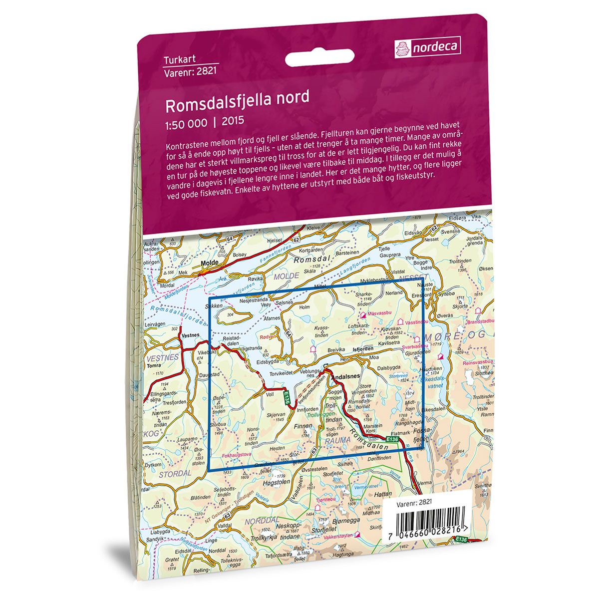
The contrasts between fjord and mountain are striking. A mountain hike can begin by the sea and end high up in the mountains in just a short space of time. Many of the areas have the feel of wilderness, despite their accessibility. You can easily manage a hike up to one of the highest peaks and still be back in time for dinner. It is also possible to hike for days in the mountains further inward. Here there are many cabins, and several are located close to good fishing lakes. Some of the cabins are equipped with boats and fishing equipment.
DNT hiking maps
This map series was developed in cooperation with The Norwegian Trekking Association (DNT) and contains DNT trails, cabins and other useful trekking information. A few of the maps also have ski trails.
The DNT maps are published in three different scales (levels of detail).
1:25 000 for more defined and detailed information. Suitable for shorter treks.
1:50 000 is the optimal scale for treks.
1:100 000 offers a good overview of larger areas and is useful when planning trips.
The maps are printed on durable and weatherproof plastic fibre or paper material.
Language: Norwegian and English