Norway
  Deutsch
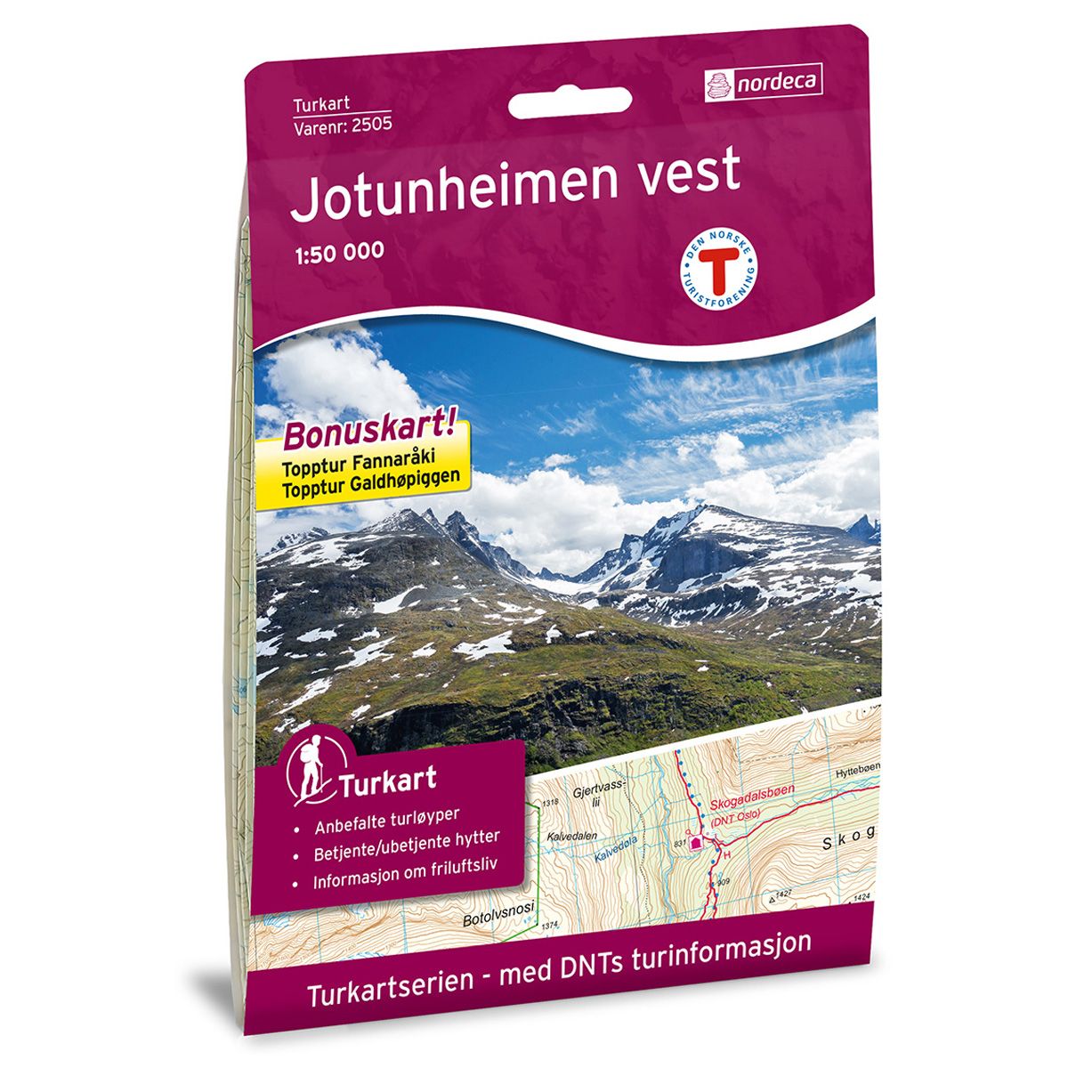


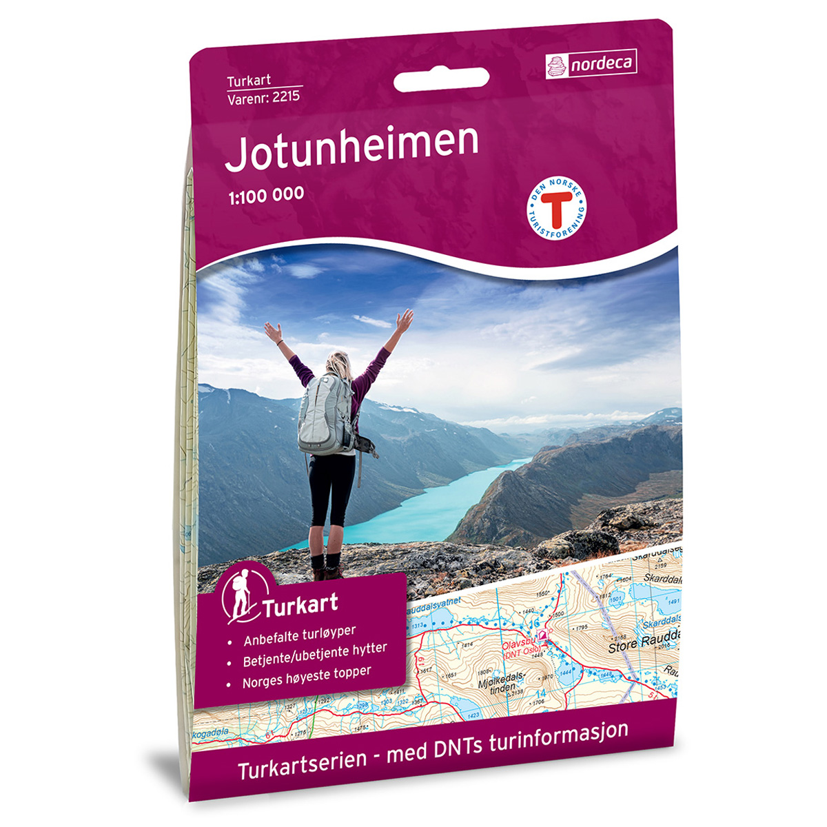
Jotunheimen Vest DNT hiking map
Map with Norwegian Trekking Association information about trails and cabins.
- The map covers Galdhøpiggen, Hurrungane, Skarstølstindane og Sognefjellet
- Scale 1:50 000 in water resistant material
- Bonus map: Summit hike Fannaråki and summit hike Galdhøpiggen
€24.00
In stock
| Brand | Nordic Maps |
|---|---|
| SKU | 2505 |
| Map size | 70x100 cm |
| Scale | 1: 50 000 |
| Trails | Hiking trails |
| Updated | 2018 |
| Material | Plastic fiber |
| Map usage | Hiking, Cross Country |
| Accommodation | Serviced cabins, Unattended cabins, Self-catering cottages, hotels |
| Attractions | Sognefjell |
| Bonus map | Topptur Fannaråki og topptur Galdhøpiggen |
| EAN | 7046660025055 |
| Cabins in the map | Tyinholmen høyfjellsstuer, Gravdalen, Avdalen, Fondsbu, Eidsbugarden hotell, Vetti Gard turiststasjon, Stølsmaradalen, Vormeli, Skagastølsbu, Skogadalsbøen, Olavsbu, Tindeklubhytta, Turtagrø, Fannaråkhytta, Langvassbua, Nøgla, Leirvassbu, Sognefjellshytta, Stølsdalen, Krossbu, Spiterstulen, Bøverton, Nørdstedalseter, Bøvertjønnen, Jotunheimen fjellstue, Bøverkinn sæter, Juvasshytta, Medalsbu, Elveseter hotell, Raudbergstulen, Storhaugen, Lund camping, Leirmoen camping, Trulsbu, Galde uppigard, Galdesanden camping, Bøverdalen vandrehjem, Røisheim, Geitåbua |
| Partner | The Norwegian Trekking Association |
| Map both sides | No |
| Country | Norway |
| Destinations | Bøverdalen, Eidsbugarden, Galdhøpiggen, Hestbreapiggan, Hurrungane, Skarstølstindane, Sognefjellet |
| Format | Foldable |
| Language | Norwegian, English |
| Series | Hiking maps |
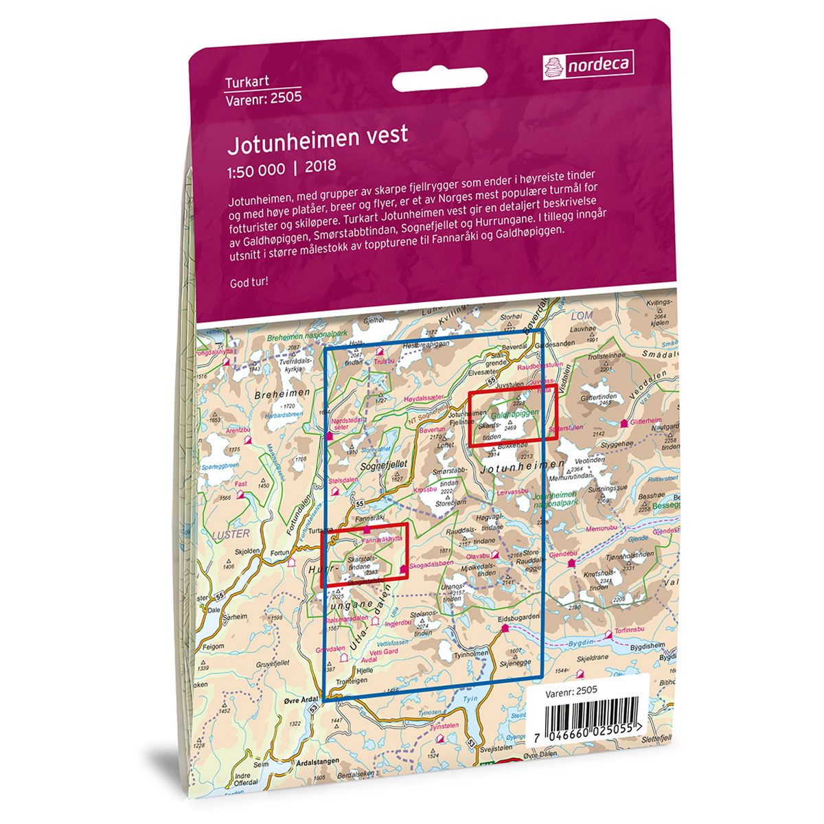
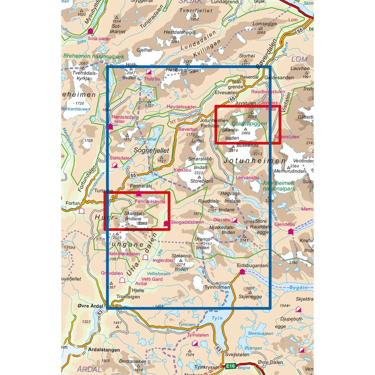
Jotunheimen, with its cluster of jagged mountain ridges, towering peaks, high plateaus, glaciers and plains is one of Norway’s most popular trekking destinations for hikers and skiers alike. The Jotunheimen West Trail Map provides a detailed description of Galdhøpiggen, Smørstabbtindan, Sognefjellet and Hurrungane. Included in the map are larger scale sections of the trails up to the peaks of Fannaråki and Galdhøpiggen.
DNT hiking maps
This map series was developed in cooperation with The Norwegian Trekking Association (DNT) and contains DNT trails, cabins and other useful trekking information. A few of the maps also have ski trails.
The DNT maps are published in three different scales (levels of detail).
1:25 000 for more defined and detailed information. Suitable for shorter treks.
1:50 000 is the optimal scale for treks.
1:100 000 offers a good overview of larger areas and is useful when planning trips.
The maps are printed on durable and weatherproof plastic fibre or paper material.
Language: Norwegian and English