Norway
  Deutsch
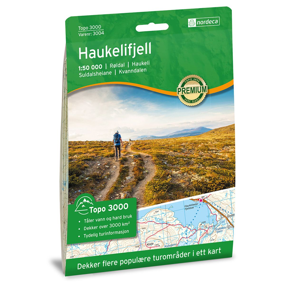
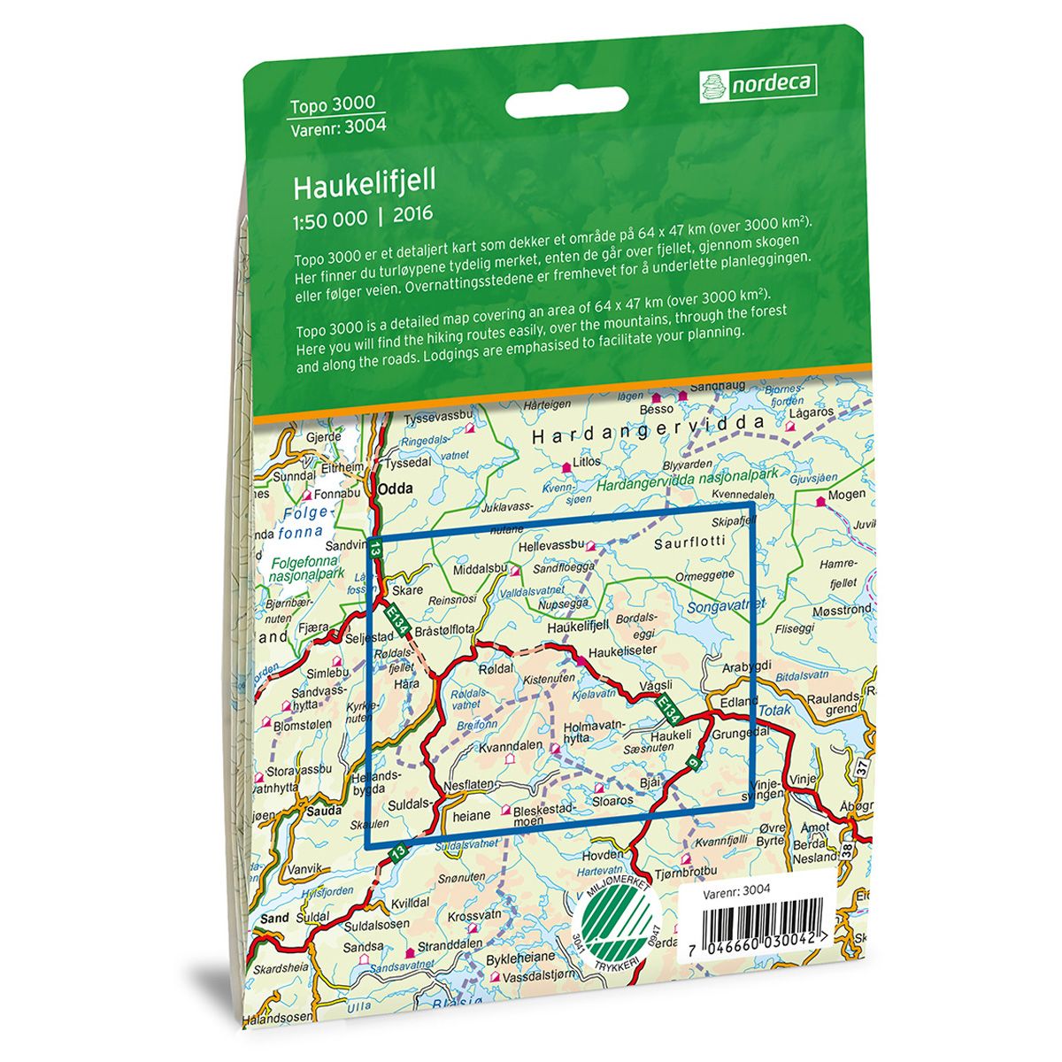
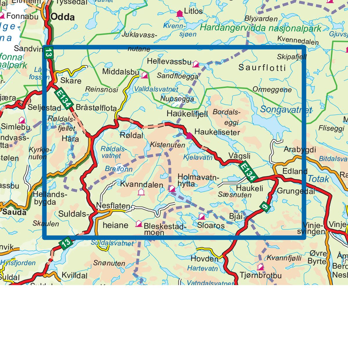


Haukelifjell Topo 3000 hiking map
Covers popular trekking areas with highlighted trekking information
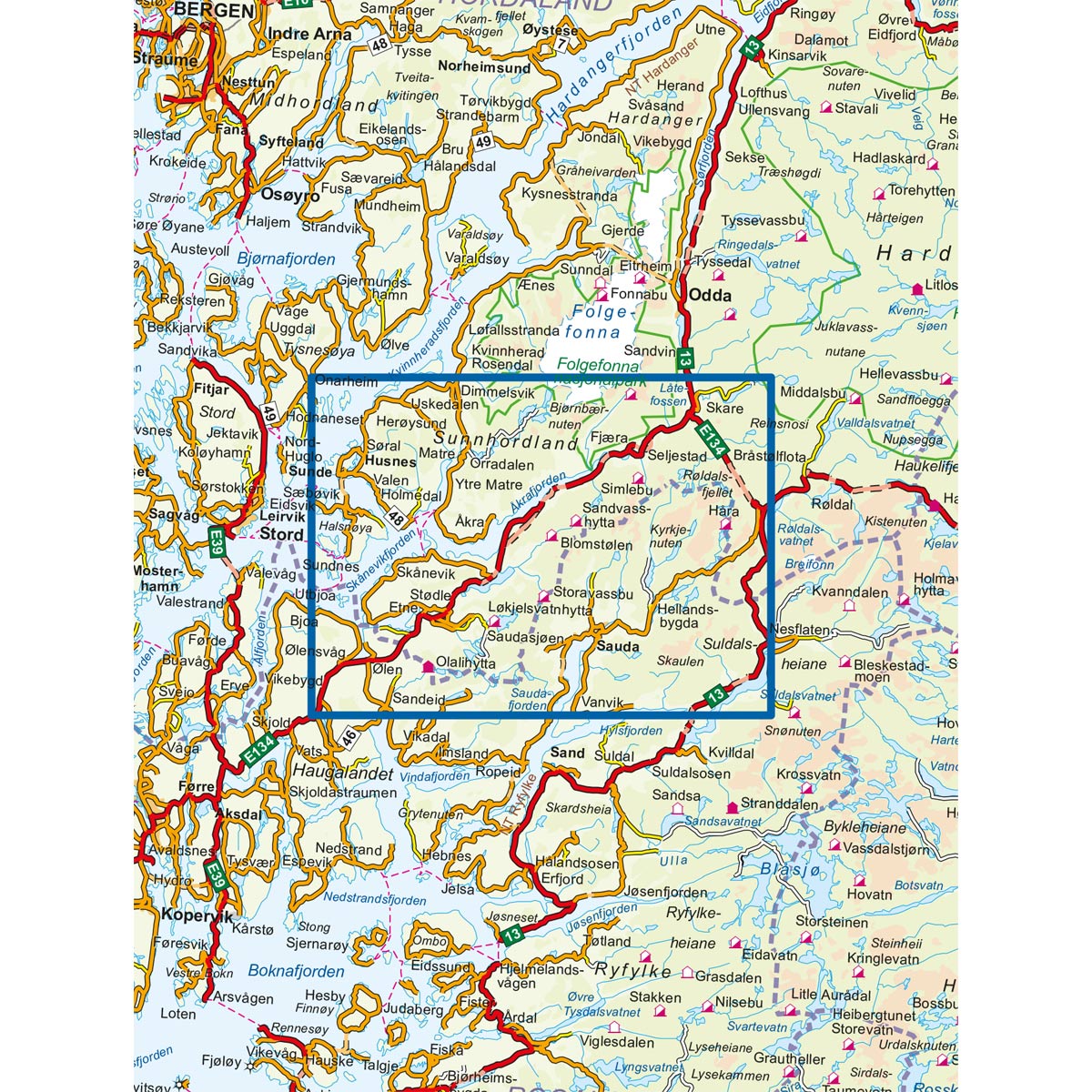
- The map covers Røldal, Haukeli, Haukelifjell, Suldalsheiane og Kvanndalen
- Scale 1:50 000 in water resistant material
€25.00
In stock
| Brand | Nordic Maps |
|---|---|
| SKU | 3004 |
| Map size | 70x100 cm |
| Scale | 1: 50 000 |
| Trails | Hiking trails |
| Updated | 2021 |
| Material | Plastic fiber |
| Map usage | Hiking, Cross Country |
| Accommodation | Serviced cabins, Unattended cabins, Self-catering cottages, hotels |
| EAN | 7046660030042 |
| Cabins in the map | Bleskestadmoen, Kvanndalen, Holmavatnhytta, Sloaros, Fjellstad, Hellevassbu, Hellevatn, Bamsebu, Glaimane, Fjarefit, Berunuten, Haukeliseter Fjellstue, Middalsbu, Sandvatnbrakka, Smerheller |
| Map both sides | Yes |
| Country | Norway |
| Destinations | Røldal, Haukeli, Suldalsheiane, Kvanndalen |
| Format | Foldable |
| Language | Norwegian, English, German, Dutch |
| Series | Topo 3000 |
Topo 3000 is a detailed map that covers more than 3000 km2. Haukeli offers activities all year around. Here you can fish, go for hikes in mountain terrain, visit the mountain pastures, cycle, swim and paddle. This is also a popular skiing area with cross-country trails, alpine slopes and peak tours. Haukeliseter Mountain Lodge is a good starting point for day trips and cabin-to-cabin treks, either northward toward Hardangervidda or southward toward Ryfylkeheiene and Setesdalsheiene. There are good trekking opportunities from Haukeliseter in both summer and winter. Some of the most popular peaks in the area are Vassdalseggi, Vesle Nup and Store Nup.
Topo 3000
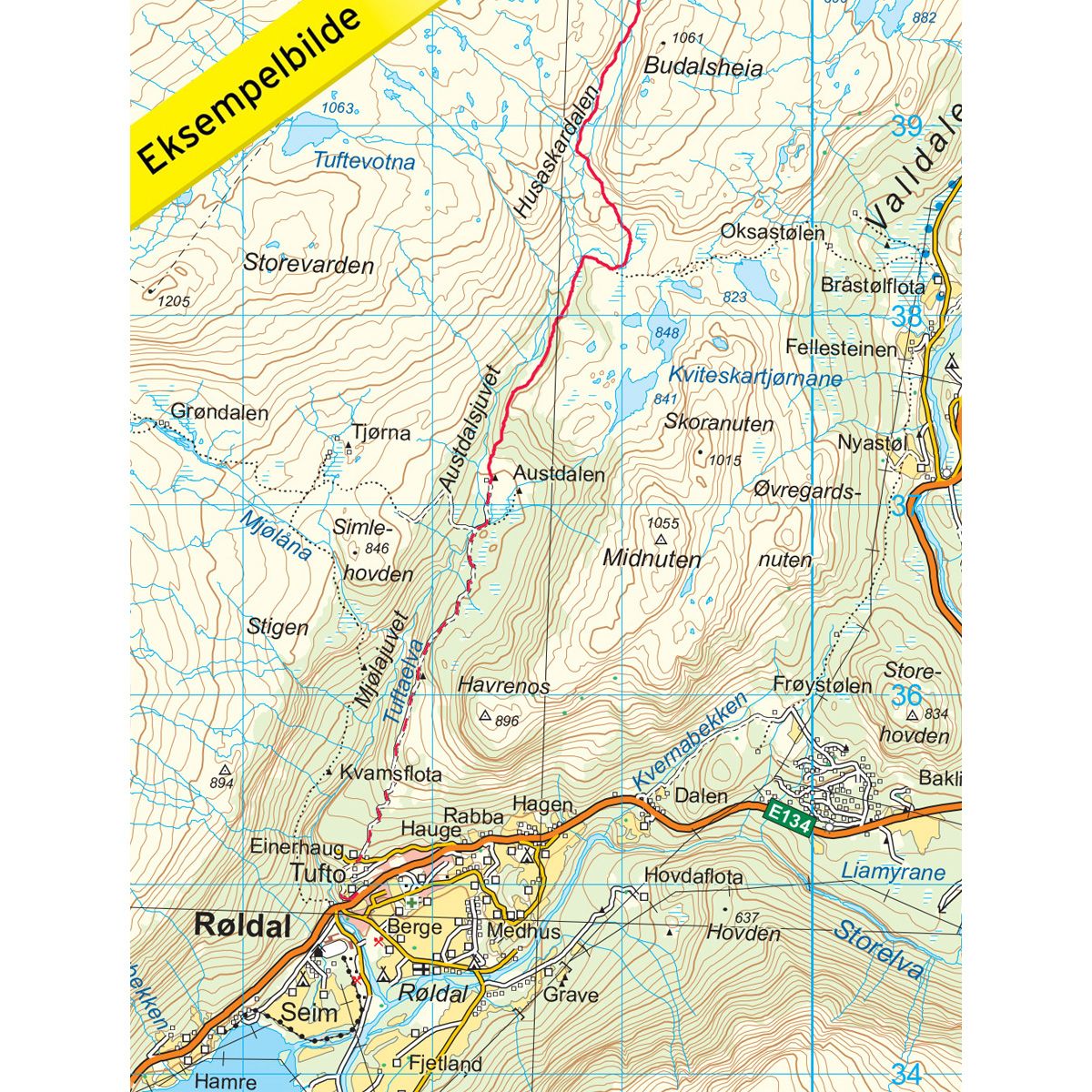
Topo 3000 is a detailed trail 1:50,000 scaled map with information from the Norwegian Mapping Authority. The map includes hiking trails, skiing trails and overnight accommodations. Trekking information is in bold type for better legibility. The trail map covers more than 3000 km2 and has been adapted to include several popular trekking areas.
The maps are printed on durable and weatherproof plastic fibre or paper material.
The series is continuously being updated to four different languages: Norwegian, English, German and Dutch.