Norway
  Deutsch
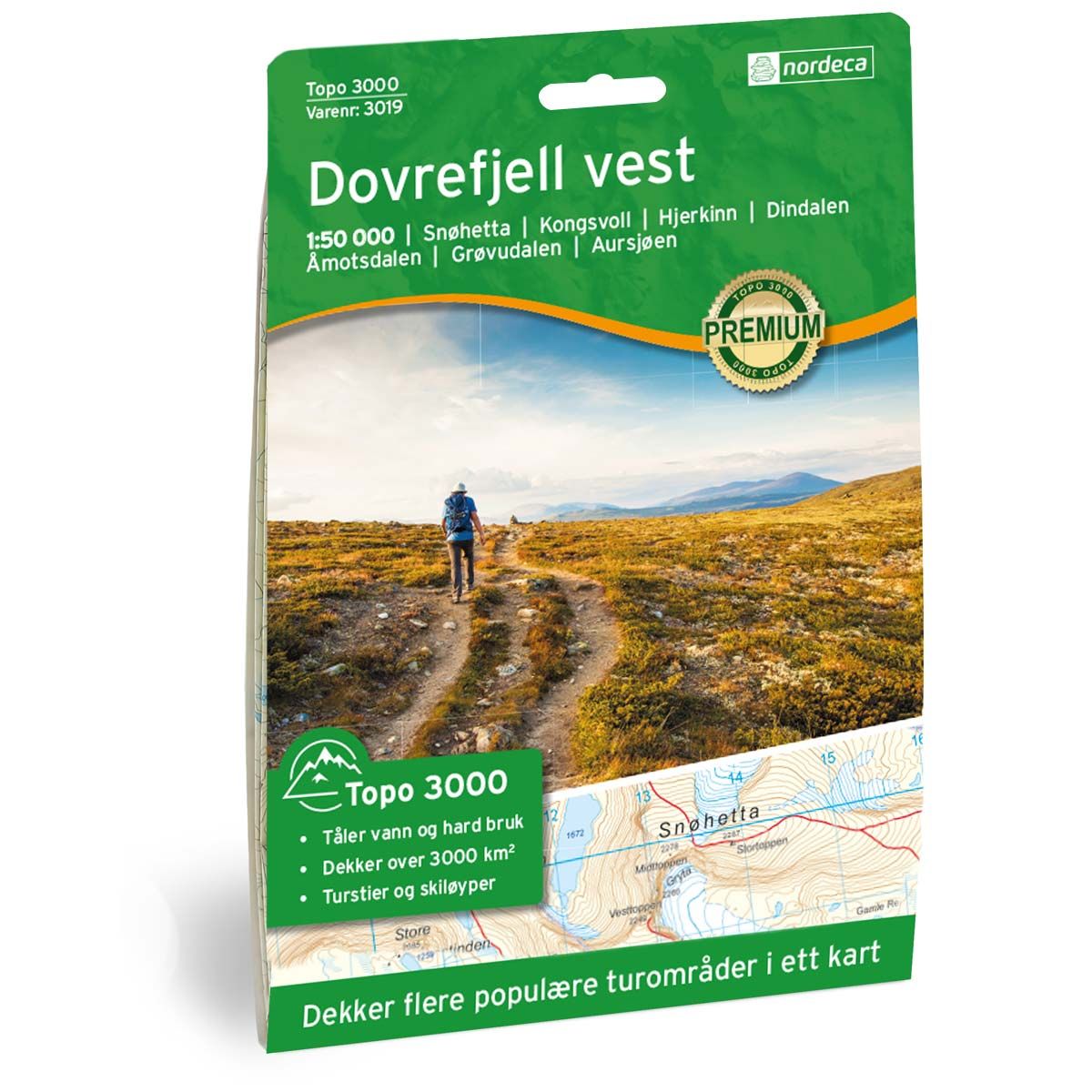
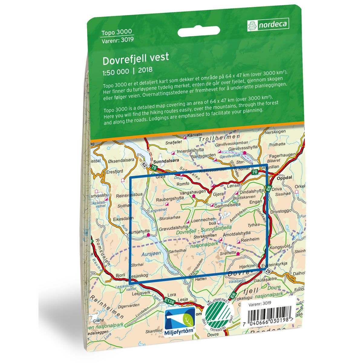
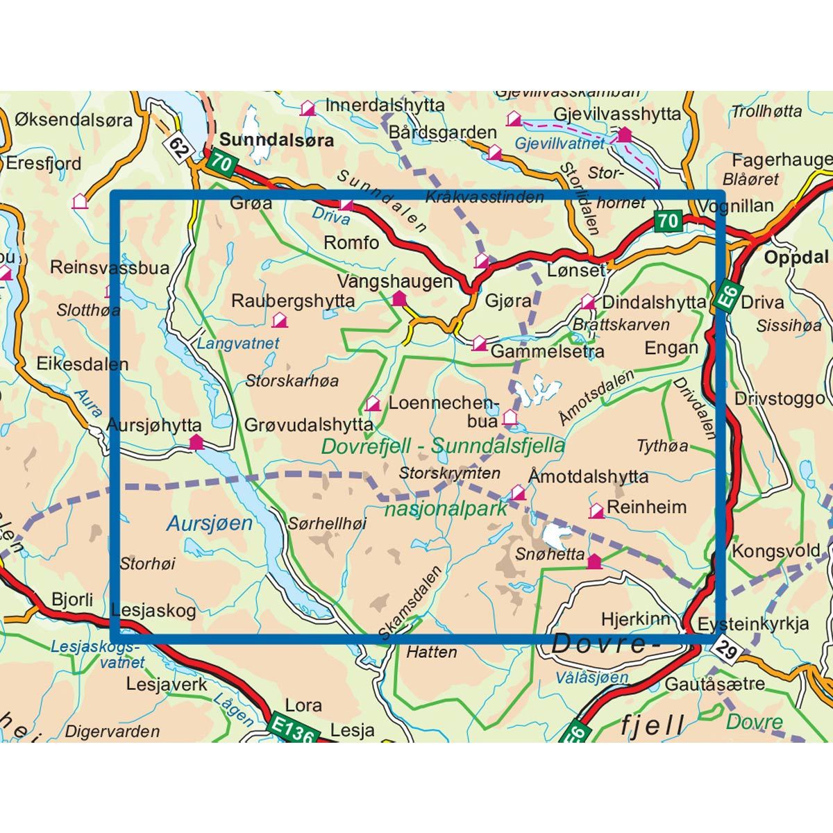

Dovrefjell Vest Topo 3000 hiking map
Covers popular trekking areas with highlighted trekking information
- The map covers Snøhetta, Hjernkinn, Åmotsdalen, Grøvudalen og Aursjøen
- Scale 1:50 000 in water resistant material
€25.00
In stock
| Brand | Nordic Maps |
|---|---|
| SKU | 3019 |
| Map size | 70x100 cm |
| Scale | 1: 50 000 |
| Trails | Hiking trails |
| Updated | 2018 |
| Material | Plastic fiber |
| Map usage | Hiking, Cross Country |
| Accommodation | Serviced cabins, Unattended cabins, Self-catering cottages, hotels |
| EAN | 7040666030198 |
| Cabins in the map | Torbudalshytta, Aursjøhytta, Raubergshytta, Eiriksvollen, Vangshaugen, Grøvudalshytta, Vollasetra, Dindalshytta, Åmotdalshytta, Snøheim, Kongsvold fjeldstue, Reinheim, Hjerkinn Fjellstue, Vangshaugen, Loennechenbua |
| Map both sides | Yes |
| Country | Norway |
| Destinations | Snøhetta, Kongsvoll, Hjernkinn, Dindalen, Åmotsdalen, Grøvudalen, Aursjøen |
| Format | Foldable |
| Language | Norwegian, English |
| Series | Topo 3000 |
Topo 3000 is a detailed map that covers more than 3000 km2. At the top of Guldbrandsdalen is the Dovrefjell mountain range with its steep mountains and deep valleys. The map covers trekking areas such as Åmotsdalen, Tverrfjellet, Grøvudalen and Snøhetta. Take a trip on foot or on skis, and perhaps you’ll catch of glimpse of wild reindeer, wolverines, ravens, golden eagles or musk oxen.
Topo 3000
Topo 3000 is a detailed trail 1:50,000 scaled map with information from the Norwegian Mapping Authority. The map includes hiking trails, skiing trails and overnight accommodations. Trekking information is in bold type for better legibility. The trail map covers more than 3000 km2 and has been adapted to include several popular trekking areas.
The maps are printed on durable and weatherproof plastic fibre or paper material.
The series is continuously being updated to four different languages: Norwegian, English, German and Dutch.